Bruce Peninsula End-to End

A Guide
In May and June of 2025 I completed the whole of the Peninsula Section of the Bruce Trail, from Wiarton to Tobermory. This is the hardest and most remote section of the Bruce Trail, so I thought it might help others if I wrote down how I arranged to achieve this goal.
SOUTH SECTION, WIARTON TO LIONS HEAD, MAY 2025
LOGISTICS FOR SOUTH SECTION
For the south section from Wiarton to Lions Head I day-hiked it with a friend over five consecutive days. We were exceedingly fortunate that my wife agreed to act as a support person, and do all the pick ups and drop offs along the way. We planned short hikes for the first and last day so we could drive from Toronto to Wiarton on the first day and from Lions Head back to Toronto on the last day.
We booked the Evergreen Forest BnB just south of Wiarton for the first two nights and Spry Church Cottage, a little west of Lions Head for the second two nights. We started out on 23rd May 2025.

Day 1) Drove to Wiarton, and started hiking from the trailhead in town. The trail began along the shore, then headed up to some ruins. It went past thousands of blooming trilliums.
Hiked to Crawford Drive at the 12.9 km mark on the Bruce Trail map, then took a short side trail 0.4 km to a free parking space at the end of a dirt road, where we were picked up.

Day 2) Hiked past Cape Croker Park at 33.1 to the later intersection with Park Drive at 35.8. This made for a 22 km long hiking day but the weather was pleasant and rain was forecast for the next day. otherwise we would have stopped at the park gate parking lot.
Note that you do not have to pay to drive through Cape Croker Park. Also, the section beyond the park includes a beautiful 900 m board walk past some ponds and marshes.

Day 3) Sun Hiked to Jackson’s Cove parking lot at 51.9 km along the trail. This would have been an 18.6 km hike if we had stopped at Cape Croker entrance but was a 16.1 km hike from where we stopped the day before.

Day 4) Hiked to Barrow Bay and walked to the end of end of McKague Rd at 69.6 km, a distance of 17.7 km. Note that parking is not allowed on this road but there is no issue with a pick up or drop off.
Day 5) Hiked to Lions Head at 82.5 km, for a distance of 12.9 km.
Total: 83 km in 5 hiking days.
COMMENTS on SOUTH SECTION
For the south section, we just carried day packs with water, lunch and rain gear. Even so, there were many sections of the trail that were very difficult. There are no sustained hills to go up or down, but there are places where the ground is very irregular. In some areas, especially at the foot of the escarpment, the trail meanders through a huge field of massive boulders. In other cases there are ropes to help. In a few places, there are well-made staircases that are a godsend!

Spring was late, wet and cold in 2025. The first day was drizzly, cloudy, with a high of 11. The weather improved to sunny with a high of 16 by the last day. The bugs were not bad and there was only one day when we bothered to put on bug spray, but also there was only one time we put on sunscreen.
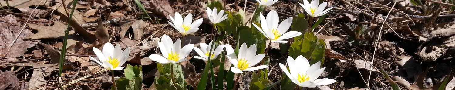
The wildflowers were amazing. There were huge fields of trillium still in good condition, masses of violets, lots of ostrich ferns, but the only orchid we saw was a few hardy yellow ladies slippers. The apple trees and serviceberries were in full bloom.

We saw fresh bear scat on the trail a couple of times. Then, on the fourth day we heard a rock moving on the shore beside the trail. We looked down the 20 ft cliff to see a mother and large baby black gear! Fortunately they were walking away from us and never noticed us.
NORTH SECTION: LIONS HEAD to TOBERMORY, JUNE 2025
LOGISTICS FOR THE NORTH SECTION, LIONS HEAD TO TOBERMORY
Based on four people in two cars, taking seven hiking days
Day 1) Drove to Tobermory Village campground in two cars. Parked one car there. Packed into the second car and drove to Mountain Trout, a 30-minute detour. We dropped off food for days 2-5, then continued to Lions Head. Parked the second car there. Note that there is no overnight parking at the Lions Head Arena, and the campground only allows campers to park there. The marina charges $30/night. Mike, the owner of Mountain Trout Camp, kindly allowed us to park on his own driveway in downtown Lions Head, a five-minute walk from the trail, for $15 per night.

Hiked to Reeds Dump. (9 km). This begins as an easy walk through the suburbs of Lion’s Head on a minor road, then turns into some woods and finally descends to a rocky beach. Turn right and look for paths back up into the woods. There are at least two campsites, each with room for at least three tents. There are fire pits, but fires are not allowed. There is easy access to the lake for water (which should be boiled, filtered or treated). There are no toilet facilities. This is effectively an area where wild camping is allowed. There is no booking system, and there are no fees. We had the place to ourselves and loved it!

Day 2) and 3) The next campsite north of Reed’s Dump is Mountain Trout, about 2 km east of the 120.4 trail label. Some enthusiasts can do the 30 km in one day, but we were able to persuade Mike from Mountain Trout to pick us up at Cape Chin North. He then dropped us back at the same point the next day. We paid him $200 for the shuttle in his nice big air-conditioned pickup truck, and it was worth it! This meant that we could leave our tents up for two days and hike with only a day pack on day 3. We liked Mountain Trout Camp. The staff were very helpful, and we could store our food bags in their office as they had no bear boxes or suitable trees for a bear hang. There is a small beach where I went for a swim. They sell cold drinks, ice cream and firewood, so we had the only campfire of the trip there. The hot showers were welcome after two days of difficult hiking in a heat wave. Try to get site A9, which is covered in wood chips rather than gravel, and is quite secluded, with easily room for three tents.


Day 4) Mountain Trout to High Dump. This was another hot day, so some of us cheated a little bit and had Mike drive us the 6 km along a dirt road to the point on Crane Lake Road where the road was closed to vehicles due to flooding. Lindsay Rd 40 between Bartley Dr and Crane Lake Rd is actually quite a lovely walk with trees shading the road.

After the road closed sign, the road is covered in water. The first two ponds we skirted around, but we got our boots wet and muddy. After that, there were several deep pools of water, so we changed into our camp shoes and waded through. After a few ponds, there is a dry area with multiple large rocks to sit on as you dry your feet and change back into hiking boots. Eventually, the road ends at a parking spot, and it is another 8 km to High Dump. This turned out to be a forestry road that was the best hiking of the whole trip. We were able to make fast progress. In a few places, corduroy roads had been set up to cover wet patches. Some were in good repair, others required careful foot placement.

It was on this stretch of road that we saw a rattlesnake. I might have missed it, as it was well camouflaged and lying still among twigs and leaf litter in the middle of the road. It noticed us and gave us a warning rattle. We took a wide detour through the bush and headed on to High Dump.

There are two back country camp sites along the route, High Dump and Storm Haven. Both have campsites in the woods on platforms (which were barely big enough for two small tents. They have nice composting toilets, and metal poles to use to hang your food away from bears. Fires are not allowed and water comes from the lake and needs to be treated. Theses campsites must be booked months in advance. There is a crazy system involved. You book online, pay, and get a confirmed reservation, but this is not your camping permit. You are meant to show up in person at the Cyprus Lake campground the day of your hike, pay a day use fee and sign some form. You cannot do this by phone in advance, not can you do it the National Park Visitors Centre in Tobermory. In the end we decided this was just silly, so we never got our actual permit, but no-one checked.
At High Dump some of the sites (e.g.3 and 7) are quite a way up hill away from the lake. Sites 2 and 4 are much more convenient.


Day 5) High Dump to Storm Haven. This is only about 8.5 km, but it is possibly the hardest section of the Bruce Trail, with repetitive minor ups and downs. Unfortunately, it rained almost he whole day, making the rocks slippery. It took us about six hours, with only very short stops for snacks as we got cold as soon as we stopped.

At Storm Haven, sites 6, 7, 8 and 9 are down by the water. The other sites are up by a dirt road, a long walk from any water source. We had sites 6 and 9. This was one area where we couldn’t get Internet access, which was frustrating, as the last weather forecast we received indicated that the whole of the next day would be cool and quite rainy. The site was beautiful, but we were really cold and wearing every layer we could find. Another long cold wet day had no appeal!

Day 6) This proved to be a long and hard day, even though we only hiked 14,4 km. The trail goes past the very touristy Grotto area. It has sections on rocky beaches that are scenic but hard on the feet. Two faster hikers went ahead to the parking lot at Little Cove, left their packs with the attendant, hiked to the campground and came to collect us. We were so grateful! We had set off at 8:15. The fast hikers arrived at the car park at 1:30 pm and we arrived there at 4:15 pm. The trail begins hard, then there are some easier r=sections, a muddy wildflower meadow, and then suddenly more difficult areas. pop up. We were all quite glad to se the end of this section!

Day 7 This is only 7 km of fairly easy hiking on the Bruce Trail, but if you cannot arrange a ride there is an additional 3 km of road walking to get from the campsite tot he trailhead, and another 3 km from the end of the trail back to the campsite. The Tobermory Village Campground was not able to arrange a shuttle for us, so I drove to the start, walked around Tobermory, then parked in the Bruce National Park Visitors Centre ($15.75). I walked up the fire tower, went into Tobermory to look at the harbour, and then joined the rest of the group for the final 10 minute walk into Tobermory.

An alternative approach would have been to divide the party into two groups. One group would be dropped off at Little Cove. The others would drive to Tobermory, park, and walk from the end of the trail towards Little Cove. Somewhere along the trail, they would meet and transfer the car keys so that the people arriving in Tobermory could then pick up the others at Little Cove.
| Day | Start | Finish | Distance in ems (and km on road) | Estimated time in hours based on 2 km/hr on trail. 3 kph on road. |
| 1) Sunday 22 June | Lions Head | Reed’s Dump | 9. 5 km incl 3.5 on road | 4.25 hrs |
| 2) Mon 23 | Reed’s Dump | North Cape Chin Rd at 106.9 Camp at Trout Lake | 13.9 | 7 hrs |
| 3) Tue 24 | Cape Chin Rd | Mountain Trout Camp | 15.8 Day pack only | 8 hrs |
| 4) Wed 25 | Mountain Trout | High Dump | 16.8 incl 8.8 on road | 7 hrs |
| 5) Thu 26 | High Dump | Storm Haven | 8.8 km | 4.5 hrs |
| 6) Fri 27 | Storm Haven | Tobermory Village Campground | 17.4 incl 3.5 on road | 8 hrs |
| 7) Sat 28 | Tobermory Village Campground | Tobermory | 8.9 incl 2 km on roads | 4 hrs |
GENERAL ADVICE FOR BRUCE PENINSULA
DANGERS
This part of the Bruce Trail includes several remote areas where cell phone service cannot be guaranteed, and evacuation would be difficult. The trail often goes for several kilometers without an easy way to abort and get to safety.
The trail is rocky with steep cliffs. There area also cracks and holes in the rock of the trail. Be very careful where you put your feet. The rocks can be slippery.
It can be very hot with a risk of dehydration. When walking on the top of the escarpment water access may be difficult. We carried 2 – 3 litres of water to avoid dehydration. Even in summer there are cold wet days when hypothermia is possible.
We saw four black bears, but none of them took any interest in us. Be aware of what to do if a bear approaches you. Hang your food from a tree at night. or use the bear hang poles at Storm Haven and High Dump sites. We bought two small air horns in case we needed to scare bears away.


We saw two foxes and heard both wolves and coyotes. None of these are likely to attack humans.
We saw oneMassassauga rattlesnake, basking in the sun in the middle of our path, Apparently in high summer they are so common that locals avoid using the trail. They are well camouflaged among litter on the forest floor. Fortunately we saw it and took a safe detour around it.
There are probably ticks in the area but we did not see any. Check for ticks regularly, and bring a tick removal tool. Consider bringing doxycycline for treatment of prolonged tick bites.
There is poison ivy in places. On days two and three it was intruding onto the trail, so long trousers are needed.
NAVIGATION AND COMMUNICATION
Cellphone coverage is spotty. At some sites, such as Storm Haven, we were unable to connect to the Internet to get a weather forecast. In other locations, we were able to send and receive emails. Text messages seemed more reliable and usually went through, especially if we kept on walking until the phone got a signal. If you have access to something like a Garmin InReach emergency communication system, you should probably bring it.

CONCLUSION
We were delighted that we made it! It was a hard slog, and the initial heatwave followed by a cold, rainy day really tested us to our limits.

Would we do it again? We all said that we would not! We enjoyed the campsites and the wildflowers. The first time you see the teal and turquoise blue of the water from the top of the escarpment, it is an amazing sight. After a few days, we only stopped at the viewpoints if we were waiting for someone or thought it was worth a photo. The hiking was frequently very hard, although there were some easier sections, especially on the last day.
POSTSCRIPT: NATURE OBSERVED ON THE WIARTON TO LIONS HEAD SECTION IN MAY
- TREES
- Apple
- Basswood
- Beech
- Chestnut
- Elm
- Hawthorn
- Hybrid Red/Silver Maple
- Ironwood
- Manitoba Maple
- Maple
- Oak
- Poplar, Balsam
- Poplar, Trembling
- Red maple
- River Birch
- White Birch
- SHRUBS
- American Beaked Hazelnut
- American fly honeysuckle
- American Hazelnut
- Canada buffalo berry
- Elderberry
- Gooseberry
- Northern bush honeysuckle
- Serviceberry
- Striped Maple (Moose Maple)
- FLOWERS
- All three violets(white, yellow,purle)
- Blue Bead lily
- Canadian Lousewort
- Carolina Spring Beauty
- Coltsfoot
- Coral Root
- Cutleaf Toothwort
- Dandelion
- Drooping Woodland Sedge
- Evening primrose
- False (plyume) Solomon”s seal
- Foam Flower
- Graceful Sedge
- Grey Reindeer Lichen
- Hairy Sweet Cicely
- Indian paintbrush
- Large flowering bellwort
- Large leaved aster
- Marsh marigold
- Mountain Sweet Cicely
- Northern Star flower
- Pennsylvania Sedge
- Poison Water hemlock
- Rattlesnake plantain
- Red Trillium
- Sasparilla
- Sharp lobed hepatica (not in bloom)
- Showy Lady Slipper
- Small flowering buttercup
- Stary false solomon’s seal
- Tall rattlesnake root
- Trout Lily(dog toothed violet)
- Two leaved Mitrewort
- White baneberry
- White Trillium
- Wild Basil
- Wild Ginger
- Wild Leek
- Wood Columbine
- Woodland buttercup
- FERNS
- Bracken fern
- Bulbet fern
- Maidenhair spikewort
- Northern Holly fern
- Ostrich fern
- INVASIVE SPECIES – No DSV seen!
- Annual honesty
- Buckthorn (some, not much)
- Forget me not
- Garlic Mustard (not much till close to cottages and roads)
- Goutweed
- Hairy honeysuckle
- Lily of the valley
- Morrows honeysuckle
- Solomon’s seal
- Tartarian honeysuckle
- Water avens
- Yellow and red primrose (cowslip)
- BIRDS
- American redstart
- Baltimore Oriole
- Barn Swallow
- Black and White Warbler
- Black Throated Blue warbler
- Black Throated Green warbler
- Blue Jay
- Canada Geese
- Cardinal
- Cedar Waxwing
- Chickadee
- Chipping sparrow
- Common Merganser
- Common Yellowthroat Warbler
- Cormorant
- Crow,
- Dark eyed junco
- Flicker
- Goldfinch
- Great Blue Heron
- Great White Egret
- Kildeer
- Least Flycatcher
- Loon
- Mallards
- Oven Bird
- Pileated Woodpecker
- Raven
- Red Eyed vireo
- Red Winged Blackbird
- Ring billed Gull
- Robin,
- Rose Breasted Grosbeak
- Ruffed Grouse
- Scarlet Tanager
- Song Sparrow
- Turkey Vulture
- White breasted Nuthatch
- White throated sparrow
- Wild turkey
- Wood Peewee
- Wood thrush
- Yellow Warbler
- ANIMALS
- Black bear
- Chipmunk
- Porcupine
- Red squirrel
- Spring Azure butterfly
Comments
Bruce Peninsula End-to End — No Comments
HTML tags allowed in your comment: <a href="" title=""> <abbr title=""> <acronym title=""> <b> <blockquote cite=""> <cite> <code> <del datetime=""> <em> <i> <q cite=""> <s> <strike> <strong>